
1
Day 1, 2 October: gaining altitude
After a climb of one kilometer from the valley of Champoleon I came to a grassy plain at an altitude of 2.300 meters. The lower flanks of the Sirac raised in a bowl shape to the east. In the west the sharp peaks of the Aigle des Morges were clearly visable. I had pitched my tent just before dark, amazed by the deafening silence.
View of the valley of Champoleon
The peaks of Aigle des Morges
Day 2, 3 October: to the valley of river Severaise
At 4:00 I woke up excited and started the day. It was completely dark when I walked to the slopes of Col de Vallonpiere. To trace the path towards the mountain pass, I used a picture from the previous day. On the picture the path was clearly visible on the slope. I reached the pass at about six in the morning when the sun already struck the higher ridges in the north. I went down to a road, hoping for a hitch-hike to La Chapelle en Valgaudemar, ten kilometers to the west. Only one car drove by, I had to walk. La Chapelle a path went up again on the flanks of the L’Olan. In the vegetation I spotted a praying mantis. It was warm. After a climb of nine hundred meters I reached a level valley at 2050 meters, just before dark.

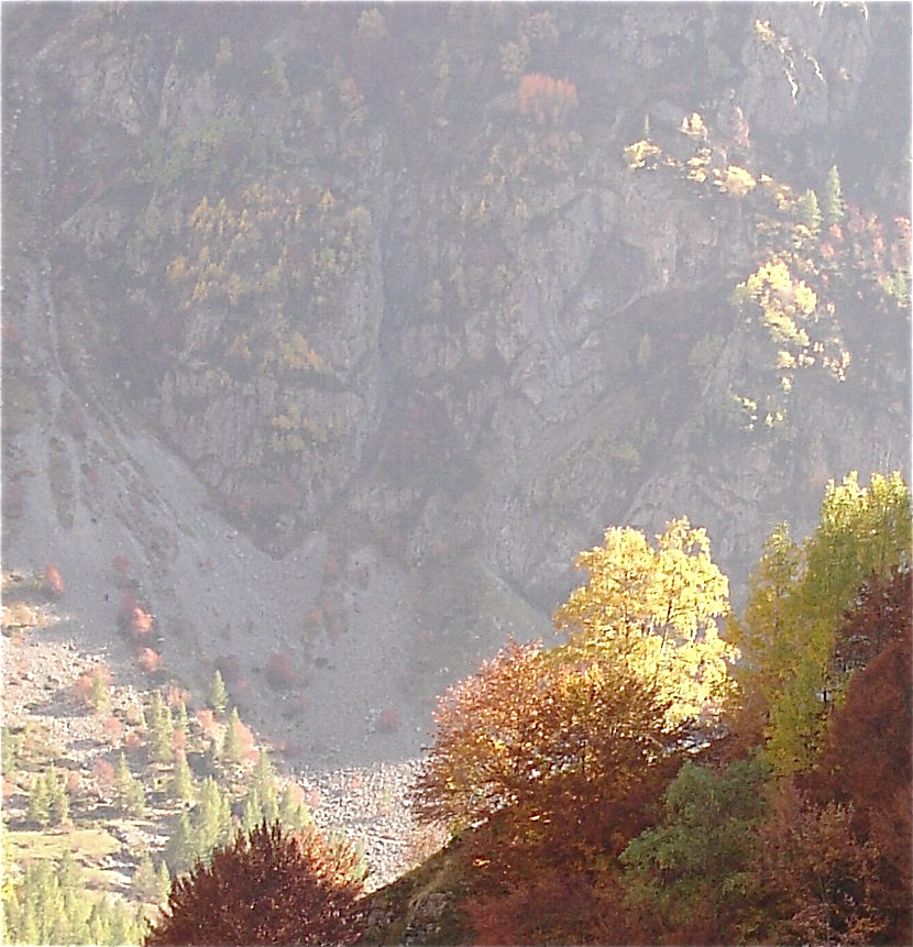
Early sunstroke at Pic de Vallon Clos

Coral reef above the sea?
Day 3, 4 October: into the valley of river Bonne
Again I started to walk early, at about 5:00 in the morning. I climbed the Col de Colombes (2420 meters) in the dark. I slept two hours at a sheltered spot at the Col. Two mountaineers came along and asked if I wasn’t cold. ‘Non’ I replied half a sleep. It took about the whole day walking along the flanks under the Pic des Souffles to reach the Col de Vaurze at an altitude of 2500 meters. From here a steep (and I mean steep!) path went down to the little town of le Desert (1200 m).

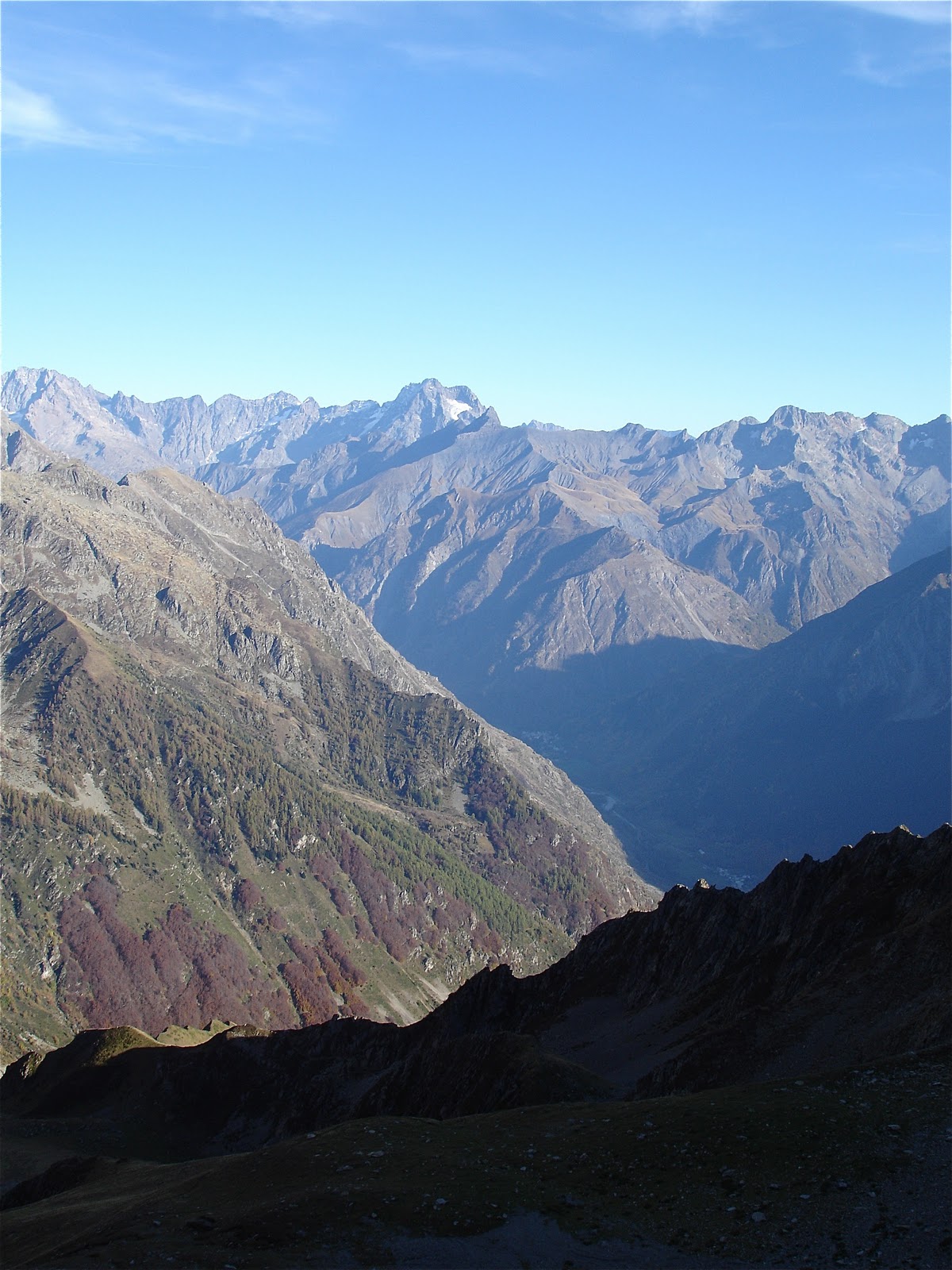
View from the sleeping bag

Flanks of the Tete de Clotonnet
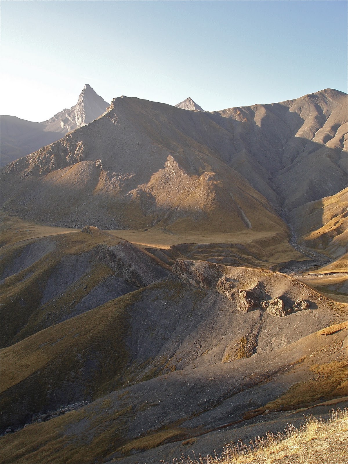
View on the Sirac

Piles of rocks that have been gathered to clear the fields, in Le Desert.
Day 4, 5 October: into the valley of river Beranger
The next morning I walked up towards the Col de Marmes (2290 m), which I reached after four hours. To the north I spotted the Col de la Muzelle, which seemed as steep as a vertical rock. I could not imagine a path really went over that pass. I went down another thousand meters to reach the valley of the Beranger River. I had my doubts whether to continue, or to walk to the town of Valsenestre to make an end to this trip. Already I had climbed and descended three thousand meters with a 15 kg backpack. My legs really needed some rest. After some bread and several cups of tea the energy had come back, and I decided to start the walk up towards the Col de la Muzelle. I brought one liter of water from the clear stream. The rest I would get from another stream up the slope, which got its water from a little glacier. The water however had dried to dust. At the same time at the other side of the narrow and deep valley, water rushed loudly from the mountains. As if yelling ‘come and get me!’
View on the Col de la Muzelle
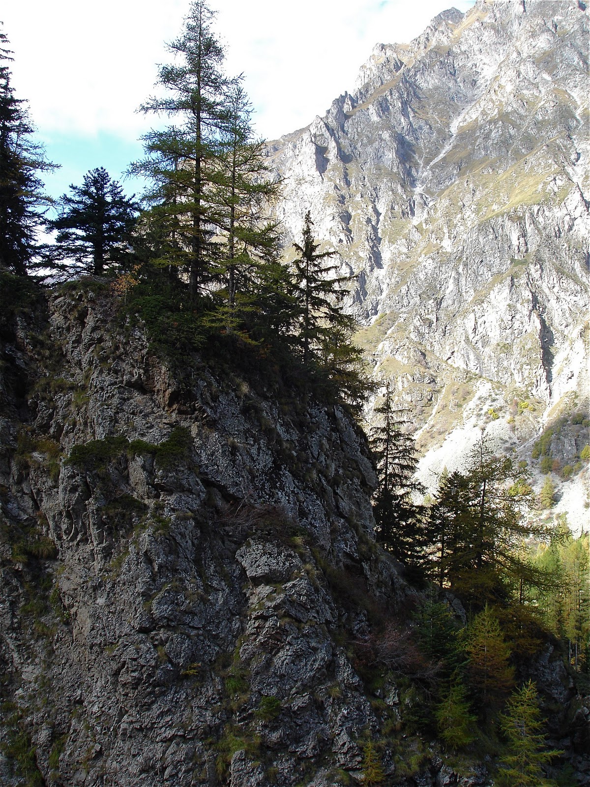
Pinetrees on a rock
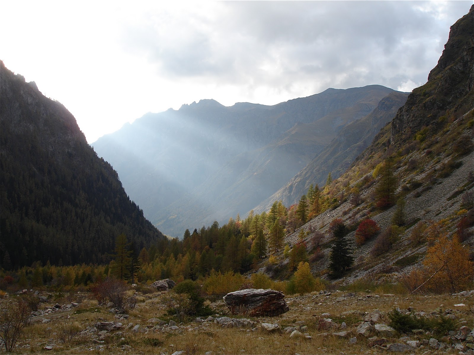
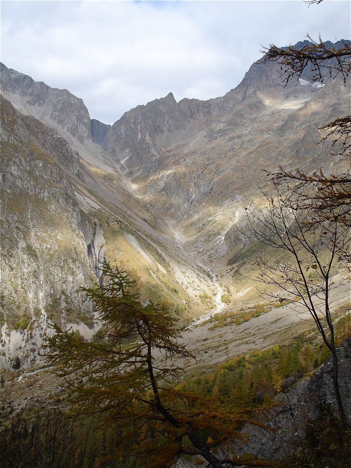
Valley of River Beranger
Day 5, 6 October: into the valley of river Veneon
The last two hundred meters up the Col de la Muzelle were very steep as I expected. I had my doubts if I would reach the pass at all. Finally at the top the dense clouds limited the view. I went down a moon like landscape. The weather cleared up when I reached the Lac de lla Muzelle. Far to the north I noticed the ski resort of Les Deux Alpes at the top of the hills. No such thing was over here. I went down a beautifull path and reached a level forest near the rushing river,to find a place just large enough for the tent. In total I had climbed and descended four thousand meters, which gave an indescribable, victorious feeling. It reminded me of the off -track descent of the Hallingskarvet Mountain in Norway a few years ago.

Backward view at Colles de Marmes
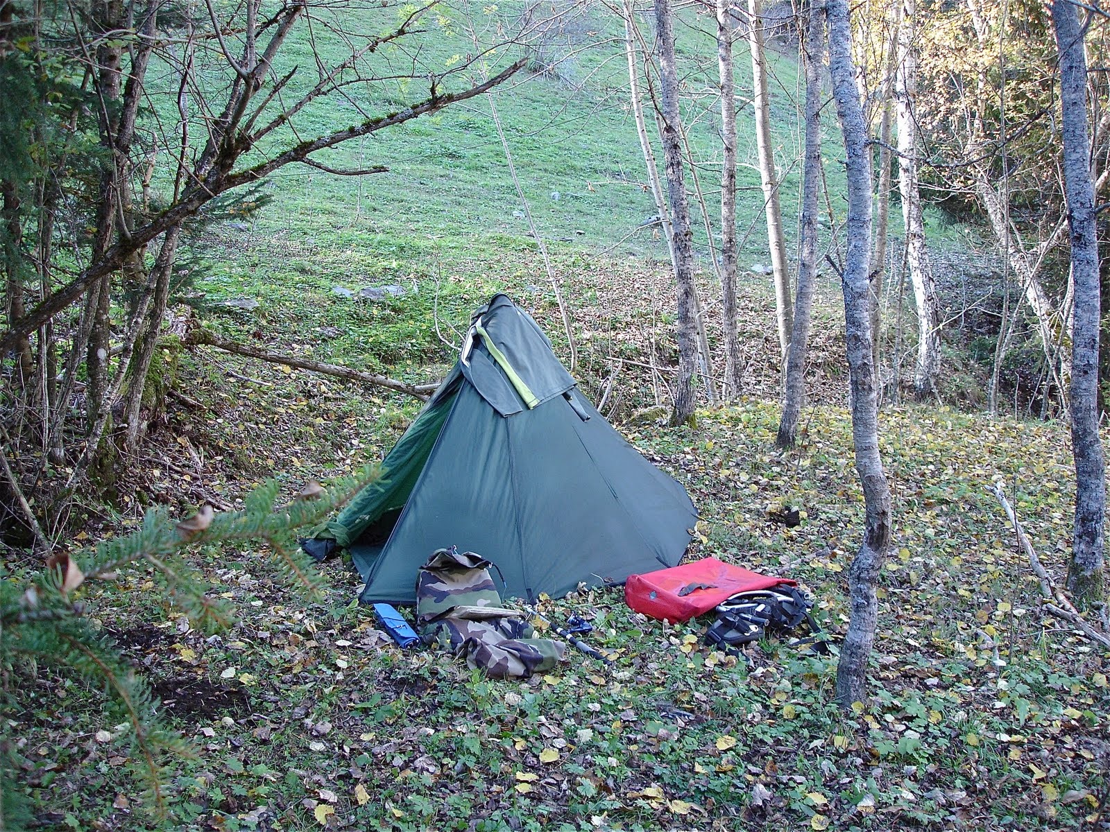
Great final tentspot near Rousseau de Pisse
The next day I went to the town of Die, which I reached very late in the evening because of a train strike. I was lucky that my uncle and aunt, who were staying in Die, could get me from the train station of the not so nearby city of Gap. Thanx Lionne and Egbert!
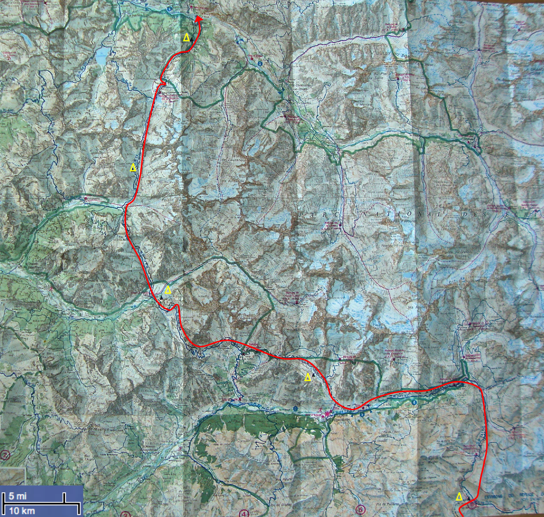
Map of the walking route, double click to enlarge.